For over 40 years, the Jornada LTER program has collected data in the Chihuahuan desert according to several core research themes. These themes and selected long-term datasets are highlighted in Tab 1, below. The entire primary Jornada LTER data catalog, hosted at EDI, is searchable in Tab 2, and Jornada data holdings in other repositories are in Tab 3. Selected spatial data layers are in Tab 4, and data from partner networks in the Jornada Basin can be found in Tab 5. For help with data, please contact the Jornada Information Management team (jornada.data@nmsu.edu).
- 1. Core long-term data
- 2. Primary data catalog (EDI)
- 3. Data in other repositories
- 4. Spatial data
- 5. Data partnerships
Changes in vegetation cover and production
- Aboveground net primary production at the 15 NPP sites (annual summary or seasonal/species level)
- LTER transect plant line-intercept data
- JER Permanent quadrat vegetation cover
- Perennial grass responses to grazing and shrub removal
Environmental monitoring and meteorology
- NPP study automated station meteorology and soil water data
- CSIS study automated station meteorology and soil water data
- Gapfilled precipitation at the NPP study sites
Physical and biogeochemical fluxes
- Dust deposition at 18 BSNE collector sites
- Ecosystem mass and energy flux at the Tromble experimental watershed and Bajada site
Animal populations and trophic interactions
- Rodent abundance and biomass from the Ecotone study
- Rabbit survey data from the Small mammal exclusion study (SMES)
Soils, geology, and landforms
- Parent material, landform, and soil maps of the Jornada Basin (coming soon)
- Soil physical and geochemical profiles at the NPP sites (coming soon)
This listing includes citeable Jornada datasets not published in EDI, and some come from our Jornada partner networks listed in in Tab 5 (Data partnerships) of the data catalog. This listing includes both unique published datasets and web data portals. It is not comprehensive yet, but we’re working on it.
Spatial data for the Jornada Basin, including the JER and CDRRC, are managed in the Jornada GeoPortal website. A listing of public layers is displayed below, but the listing for logged-in users is more extensive, and includes interactive maps and web apps. You will need to provide an ArcGIS Online account to log in, which can be obtained from your institution (if available), or by creating a public account with ESRI (instructions here). Fill out the Jornada Spatial Data Release Agreement, including your ArcGIS Online identity, to be added to the Jornada GeoPortal user group.
Previous spatial data layers from the Jornada website are available here.
Researchers at the Jornada will find pertinent local and regional data available from numerous agencies and research groups that partner with us. Below we have assembled resources, relevant data portals, and links to individual Jornada datasets for these data partnerships. Some of the citeable datasets from these partners can also be searched in Tab 3 (Data in other repositories) of the data catalog.
AmeriFlux
There are two eddy covariance towers in the Jornada Basin that are members of the…
Army Research Lab
The Army Research Lab (ARL) has established an array of atmospheric research instruments in the…
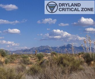
Critical Zone Network
The Dryland Critical Zone node of the Critical Zone Network is currently building some of…
LTAR (USDA)
The USDA-ARS Jornada Experimental Range is a site in the USDA Long-Term Agroecosystem Research network…

National Weather Service
The National Weather Service, part of NOAA, operates a meteorological station on the Jornada Experimental…

National Wind Erosion Network
The National Wind Erosion Research Network, a collaboration between the USDA LTAR network and the…

NEON (JORN site)
The National Ecological Observatory Network (NEON) operates the JORN observatory site on the Jornada Experimental…
NRCS
The Natural Resources Conservation Service (NRCS) operates a meteorology and soil observation station on the…
PhenoCam Network
There are 11 cameras in the Jornada Basin that are members of the PhenoCam network…