Jornada scientists often collaborate with other scientists within the LTER network to create research with implications on a global scale! Below is just one recent example of how Jornada Basin LTER knowledge is making a huge impact:
Although remote sensing can gauge biomass for the tall trees of forested ecosystems, the technology is still lacking for the short grasses and shrubs of drylands. In a changing climate, this can be a serious problem when these sensitive non-forested ecosystems occupy 70% of the Earth’s land surface and provide many crucial ecosystem services, such as carbon sequestration.
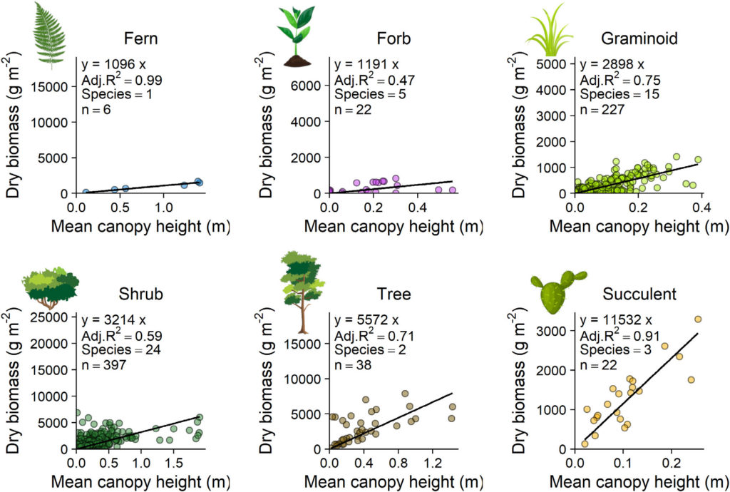
A recent study by Cunliffe et al. set out to address these accuracy issues. Jornada scientists collaborated with many others to develop a new method that uses photogrammetry and unoccupied aerial vehicles (UAVs) to remotely estimate above-ground biomass. Their results found that the vegetation canopy height measurements determined from these photogrammetric surveys are an excellent predictor of above-ground biomass. Furthermore, the estimates of biomass were just as accurate as biomass estimates from labor-intensive field surveys. This is great news, because many institutions already have the technology needed for this new method! With widespread use, this procedure could improve scientists’ ability to monitor dryland vegetation amid the future uncertainty of climate change. Click here for access to this publication.